
Bettembourg topographic map
Interactive map
Click on the map to display elevation.
About this map
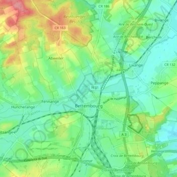
Name: Bettembourg topographic map, elevation, terrain.
Location: Bettembourg, Canton Esch-sur-Alzette, Luxembourg (49.49391 6.03939 49.55203 6.12807)
Average elevation: 289 m
Minimum elevation: 258 m
Maximum elevation: 353 m