
Lamine topographic map
Interactive map
Click on the map to display elevation.
About this map
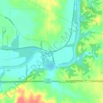
Name: Lamine topographic map, elevation, terrain.
Location: Lamine, Cooper County, Missouri, VS (38.92669 -92.89464 38.96669 -92.85464)
Average elevation: 198 m
Minimum elevation: 177 m
Maximum elevation: 239 m