
Gowrie topographic map
Interactive map
Click on the map to display elevation.
About this map
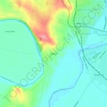
Name: Gowrie topographic map, elevation, terrain.
Location: Gowrie, Singleton Council, New South Wales, Australia (-32.58500 151.12556 -32.54500 151.16556)
Average elevation: 59 m
Minimum elevation: 30 m
Maximum elevation: 134 m
New South Wales trails, hiking, mountain biking, running and outdoor activities