
Henrys Bridge topographic map
Interactive map
Click on the map to display elevation.
About this map
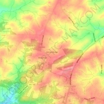
Name: Henrys Bridge topographic map, elevation, terrain.
Location: Henrys Bridge, Baltimore County, Maryland, 21131, USA (39.51122 -76.58830 39.55122 -76.54830)
Average elevation: 165 m
Minimum elevation: 103 m
Maximum elevation: 199 m