
Clare Valley topographic map
Interactive map
Click on the map to display elevation.
About this map
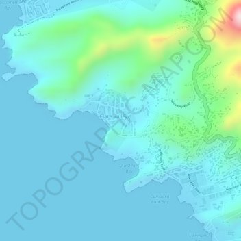
Name: Clare Valley topographic map, elevation, terrain.
Location: Clare Valley, Saint Andrew, Saint Vincent and the Grenadines (13.17486 -61.26053 13.18186 -61.25385)
Average elevation: 55 m
Minimum elevation: 0 m
Maximum elevation: 353 m