
Provincia de Chucuito topographic map
Interactive map
Click on the map to display elevation.
About this map
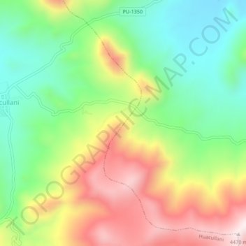
Name: Provincia de Chucuito topographic map, elevation, terrain.
Location: Provincia de Chucuito, Huacullani, Chucuito, Puno, Perú (-16.65360 -69.32181 -16.61360 -69.28181)
Average elevation: 4,125 m
Minimum elevation: 3,875 m
Maximum elevation: 4,470 m
Other topographic maps
Click on a map to view its topography, its elevation and its terrain.
Provincia de Chucuito
Perú > Puno > Conduriri > Huacullani
Provincia de Chucuito, Huacullani, Chucuito, Puno, Perú
Average elevation: 4,125 m