
Tegal Gede topographic map
Interactive map
Click on the map to display elevation.
About this map
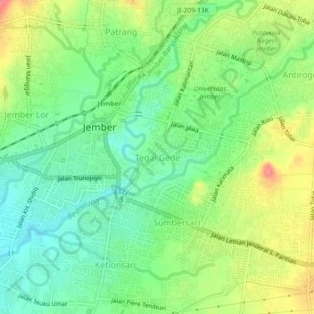
Name: Tegal Gede topographic map, elevation, terrain.
Location: Tegal Gede, Jember, East Java, 68121, Indonesia (-8.19284 113.68964 -8.15284 113.72964)
Average elevation: 97 m
Minimum elevation: 67 m
Maximum elevation: 142 m