
Probstzella topographic map
Interactive map
Click on the map to display elevation.
About this map
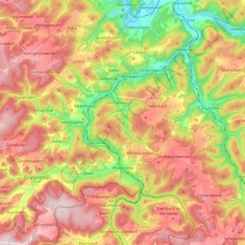
Name: Probstzella topographic map, elevation, terrain.
Average elevation: 491 m
Minimum elevation: 215 m
Maximum elevation: 735 m
Other topographic maps
Click on a map to view its topography, its elevation and its terrain.
Lichtenhain
Allemagne > Thuringe > Landkreis Saalfeld-Rudolstadt > Schwarzatal > Lichtenhain
Lichtenhain, Schwarzatal, Landkreis Saalfeld-Rudolstadt, Thuringe, 98744, Allemagne
Average elevation: 559 m