
Calingasta topographic map
Interactive map
Click on the map to display elevation.
About this map
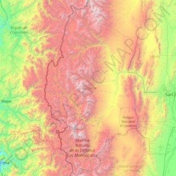
Name: Calingasta topographic map, elevation, terrain.
Location: Calingasta, San Juan, Argentina (-32.62663 -70.56968 -30.26862 -69.10017)
Average elevation: 2,393 m
Minimum elevation: 74 m
Maximum elevation: 6,583 m
Other topographic maps
Click on a map to view its topography, its elevation and its terrain.