
Payson topographic map
Interactive map
Click on the map to display elevation.
About this map
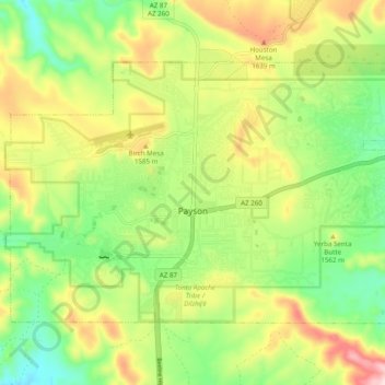
Name: Payson topographic map, elevation, terrain.
Location: Payson, Gila County, Arizona, USA (34.21706 -111.37054 34.27176 -111.27319)
Average elevation: 1,523 m
Minimum elevation: 1,379 m
Maximum elevation: 1,706 m