
Bettendorf topographic map
Interactive map
Click on the map to display elevation.
About this map
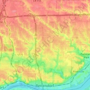
Name: Bettendorf topographic map, elevation, terrain.
Location: Bettendorf, Scott County, Iowa, 52722, United States (41.52111 -90.53302 41.61208 -90.42512)
Average elevation: 207 m
Minimum elevation: 167 m
Maximum elevation: 235 m