
Kampung Pandan Luar topographic map
Interactive map
Click on the map to display elevation.
About this map
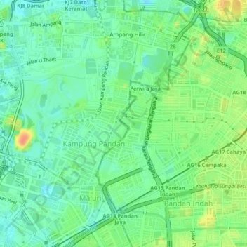
Name: Kampung Pandan Luar topographic map, elevation, terrain.
Location: Kampung Pandan Luar, Kuala Lumpur, 50600, Malaysia (3.12400 101.71954 3.16400 101.75954)
Average elevation: 49 m
Minimum elevation: 34 m
Maximum elevation: 75 m