
Shorewood-Tower Hills-Harbert topographic map
Interactive map
Click on the map to display elevation.
About this map
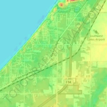
Name: Shorewood-Tower Hills-Harbert topographic map, elevation, terrain.
Location: Shorewood-Tower Hills-Harbert, Berrien County, Michigan, USA (41.86349 -86.65212 41.89975 -86.58915)
Average elevation: 192 m
Minimum elevation: 173 m
Maximum elevation: 222 m