
Kimbe topographic map
Interactive map
Click on the map to display elevation.
About this map
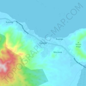
Name: Kimbe topographic map, elevation, terrain.
Location: Kimbe, West New Britain, Islands Region, Papua New Guinea (-5.59629 150.11295 -5.51629 150.19295)
Average elevation: 87 m
Minimum elevation: 0 m
Maximum elevation: 694 m
Other topographic maps
Click on a map to view its topography, its elevation and its terrain.
Talasea District
Papua New Guinea > West New Britain
Talasea District, West New Britain, Islands Region, Papua New Guinea
Average elevation: 133 m