
Tea Gardens topographic map
Interactive map
Click on the map to display elevation.
About this map
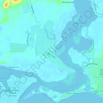
Name: Tea Gardens topographic map, elevation, terrain.
Location: Tea Gardens, Mid-Coast Council, New South Wales, Australia (-32.68227 152.13569 -32.64227 152.17569)
Average elevation: 3 m
Minimum elevation: -2 m
Maximum elevation: 41 m
Other topographic maps
Click on a map to view its topography, its elevation and its terrain.
Limestone
Australia > New South Wales > Tea Gardens > Limestone
Limestone, Tea Gardens, Mid-Coast Council, New South Wales, 2324, Australia
Average elevation: 2 m