
Ghaghara River topographic map
Interactive map
Click on the map to display elevation.
About this map
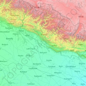
Name: Ghaghara River topographic map, elevation, terrain.
Average elevation: 1,522 m
Minimum elevation: 55 m
Maximum elevation: 7,929 m
Other topographic maps
Click on a map to view its topography, its elevation and its terrain.
Manau
Nepal > Mid-Western Development Region > Manau
Manau, Bardiya, Bheri, Mid-Western Development Region, Nepal
Average elevation: 153 m
Ghorahi
Nepal > Mid-Western Development Region > Ghorahi
Ghorahi, Dang, Rapti, Mid-Western Development Region, 082, Nepal
Average elevation: 865 m