
Mapleton National Park topographic map
Interactive map
Click on the map to display elevation.
About this map
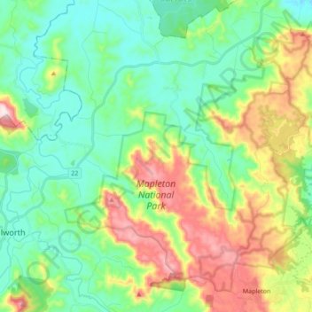
Name: Mapleton National Park topographic map, elevation, terrain.
Average elevation: 200 m
Minimum elevation: 55 m
Maximum elevation: 519 m
Other topographic maps
Click on a map to view its topography, its elevation and its terrain.
Coolabine
Australia > Queensland > Maroochydore > Gheerulla
Coolabine, Maroochydore, Queensland, Australia
Average elevation: 241 m