
Brunei-Muara District topographic map
Interactive map
Click on the map to display elevation.
About this map
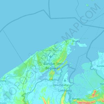
Name: Brunei-Muara District topographic map, elevation, terrain.
Location: Brunei-Muara District, Brunei (4.73433 114.66087 5.21780 115.25645)
Average elevation: 9 m
Minimum elevation: -4 m
Maximum elevation: 410 m
Other topographic maps
Click on a map to view its topography, its elevation and its terrain.