
Gülşehir topographic map
Interactive map
Click on the map to display elevation.
About this map
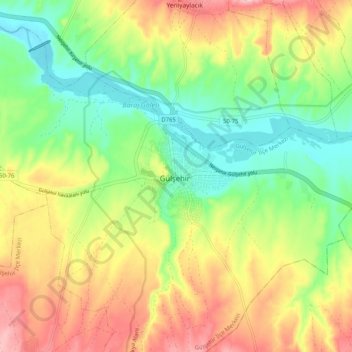
Name: Gülşehir topographic map, elevation, terrain.
Average elevation: 969 m
Minimum elevation: 894 m
Maximum elevation: 1,065 m
Gülşehir, formerly Aravissos and Arapsun, ancient Zoropassos (Ancient Greek: Ζωρόπασος), is a town and district of Nevşehir Province in the Central Anatolia region of Turkey, in the vicinity of the Fairy Chimney valley of Göreme. According to 2010 census, population of the district is 24,503 of which 8,866 live in the town of Gülşehir, and the remainder in surrounding villages. The district covers an area of 956 km2 (369 sq mi), and the average elevation is 885 m (2,904 ft).