
Cantón Naranjo topographic map
Interactive map
Click on the map to display elevation.
About this map
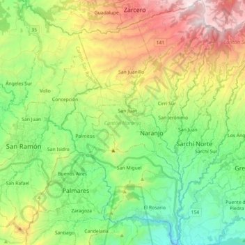
Name: Cantón Naranjo topographic map, elevation, terrain.
Location: Cantón Naranjo, Provincia de Alajuela, Costa Rica (10.01835 -84.44389 10.19224 -84.33317)
Average elevation: 1,184 m
Minimum elevation: 623 m
Maximum elevation: 2,169 m