
Bekasi topographic map
Interactive map
Click on the map to display elevation.
About this map
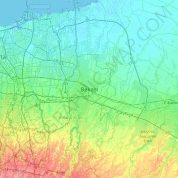
Name: Bekasi topographic map, elevation, terrain.
Location: Bekasi, West Java, 17144, Indonesia (-6.39499 106.83454 -6.07499 107.15454)
Average elevation: 23 m
Minimum elevation: -5 m
Maximum elevation: 93 m