
Pyongyang topographic map
Interactive map
Click on the map to display elevation.
About this map
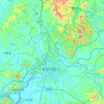
Name: Pyongyang topographic map, elevation, terrain.
Location: Pyongyang, North Korea (38.88245 125.58051 39.27953 126.03872)
Average elevation: 54 m
Minimum elevation: 2 m
Maximum elevation: 454 m
Other topographic maps
Click on a map to view its topography, its elevation and its terrain.
Mount Taebo
North Korea > Pyongyang > Pyongyang
Mount Taebo, Pyongyang, Mangyongdae District, Chollima County, Pyongyang, North Korea
Average elevation: 105 m