
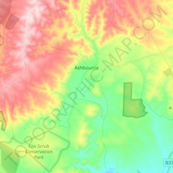
Ashbourne topographic map
Interactive map
Click on the map to display elevation.
About this map
Name: Ashbourne topographic map, elevation, terrain.
Average elevation: 218 m
Minimum elevation: 45 m
Maximum elevation: 439 m
Other topographic maps
Click on a map to view its topography, its elevation and its terrain.
Ashbourne
Australia > South Australia > Alexandrina Council > Ashbourne
Ashbourne, Alexandrina Council, South Australia, Australia
Average elevation: 197 m