
Burswood topographic map
Interactive map
Click on the map to display elevation.
About this map
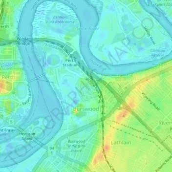
Name: Burswood topographic map, elevation, terrain.
Average elevation: 10 m
Minimum elevation: -3 m
Maximum elevation: 34 m
Other topographic maps
Click on a map to view its topography, its elevation and its terrain.
Lathlain
Australia > Western Australia > Town of Victoria Park
Lathlain, Town of Victoria Park, Western Australia, 6100, Australia
Average elevation: 17 m
Victoria Park
Australia > Western Australia > Town of Victoria Park
Victoria Park, Town of Victoria Park, Western Australia, 6100, Australia
Average elevation: 18 m
East Victoria Park
Australia > Western Australia > Town of Victoria Park
East Victoria Park, Town of Victoria Park, Western Australia, 6101, Australia
Average elevation: 21 m