
El Monte topographic map
Interactive map
Click on the map to display elevation.
About this map
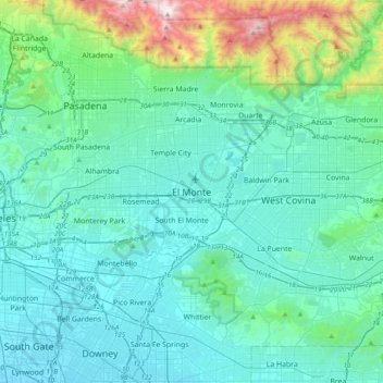
Name: El Monte topographic map, elevation, terrain.
Average elevation: 271 m
Minimum elevation: 24 m
Maximum elevation: 1,743 m
Other topographic maps
Click on a map to view its topography, its elevation and its terrain.
Hillgrove
United States > California > Los Angeles County > El Monte
Hillgrove, Hacienda Heights, El Monte, Los Angeles County, California, 91715, United States
Average elevation: 130 m