
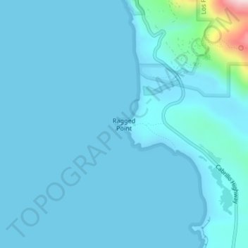
Ragged Point topographic map
Interactive map
Click on the map to display elevation.
About this map
Name: Ragged Point topographic map, elevation, terrain.
Average elevation: 26 m
Minimum elevation: 0 m
Maximum elevation: 410 m
Other topographic maps
Click on a map to view its topography, its elevation and its terrain.
See Canyon
United States > California > San Luis Obispo County
See Canyon, San Luis Obispo County, California, United States
Average elevation: 242 m
Kathleen Valley
United States > California > San Luis Obispo County
Kathleen Valley, San Luis Obispo County, CAL Fire Southern Region, California, United States
Average elevation: 516 m