
Kelvin Grove topographic map
Interactive map
Click on the map to display elevation.
About this map
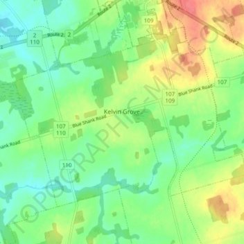
Name: Kelvin Grove topographic map, elevation, terrain.
Location: Kelvin Grove, Prince County, Prince Edward Island, Canada (46.38998 -63.67652 46.42608 -63.60167)
Average elevation: 26 m
Minimum elevation: 2 m
Maximum elevation: 64 m
Other topographic maps
Click on a map to view its topography, its elevation and its terrain.
St Lawrence
Canada > Prince Edward Island > Prince County
St Lawrence, Prince County, Prince Edward Island, Canada
Average elevation: 20 m
Alberton
Canada > Prince Edward Island > Prince County > Alberton
Alberton, Town of Alberton, Prince County, Prince Edward Island, C0B 1B0, Canada
Average elevation: 7 m
Northport
Canada > Prince Edward Island > Prince County > Northport
Northport, Prince County, Prince Edward Island, Canada
Average elevation: 2 m