
Boort topographic map
Interactive map
Click on the map to display elevation.
About this map
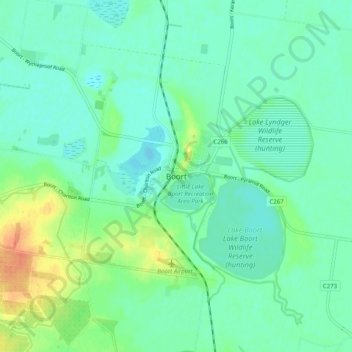
Name: Boort topographic map, elevation, terrain.
Location: Boort, Shire of Loddon, Victoria, 3537, Australia (-36.15779 143.68226 -36.07779 143.76226)
Average elevation: 96 m
Minimum elevation: 84 m
Maximum elevation: 127 m
Victoria trails, hiking, mountain biking, running and outdoor activities