
RIver Nore topographic map
Interactive map
Click on the map to display elevation.
About this map
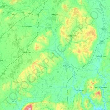
Name: RIver Nore topographic map, elevation, terrain.
Location: RIver Nore, County Kilkenny, Leinster, R95 TC63, Ireland (52.42168 -7.88977 52.98866 -6.96144)
Average elevation: 125 m
Minimum elevation: -2 m
Maximum elevation: 704 m
Other topographic maps
Click on a map to view its topography, its elevation and its terrain.
County Wicklow
The county experiences a narrow annual temperature range. Typical daytime highs range from 17–22 °C (63–72 °F) throughout the county in July and August, with overnight lows in the 11–14 °C (52–57 °F) range, although temperatures in the mountains can be 5–10 °C (41–50 °F) lower. Mean January…
Average elevation: 166 m
County Kerry
Bounded by the Atlantic Ocean, Kerry is Ireland's most westerly county. Its rugged coastline stretches for 886 kilometres (551 miles) and is characterised by bays, sea cliffs, beaches and many small offshore islands, of which the Blaskets and the Skelligs are the most notable. The county's peninsulas have a…
Average elevation: 123 m
Cork
The climate of Cork, like the majority of Ireland, is mild oceanic (Cfb in the Köppen climate classification) and changeable with abundant rainfall and a lack of temperature extremes. Cork lies in plant Hardiness zone 9b. Met Éireann maintains a climatological weather station at Cork Airport, a few…
Average elevation: 79 m
County Donegal
The majority of Donegal has a temperate oceanic climate (Köppen climate classification: Cfb), with upland areas in the Derryveagh and Blue Stack ranges classified as oceanic subpolar (Köppen climate classification: Cfc). The county's climate is heavily influenced by the North Atlantic Current. Due to the…
Average elevation: 74 m
County Meath
Meath is largely flat and much of the county lies below 100 m (330 ft) above sea-level. The minor hills in the far west of the county at Loughcrew, and in the north at Carrickleck are the only upland areas of any significance. Slieve na Calliagh, at just 276 m (906 ft) in height, is the highest point in the…
Average elevation: 64 m
County Limerick
One possible meaning for the county's name in Irish Luimneach is "the flat area"; this description is accurate as the land consists mostly of a fertile limestone plain. Moreover, the county is ringed by mountains: the Slieve Felims to the northeast, the Galtees to the southeast, the Ballyhoura Mountains to the…
Average elevation: 107 m
Julianstown
Julianstown was the seat of the Moore family who lived in Julianstown House and occupied the land that now contains the townland of Julianstown West. Taylor and Skinner's 1783 Road Map of Ireland refers to the Moore seat and also shows the Church of Ireland church which still stands today. There is little…
Average elevation: 20 m
Killeedy
Killeedy (Irish: Cill Íde) is a civil parish located south of Newcastle West in Co. Limerick in Ireland. This parish consists of two villages, Ashford and Raheenagh. The elevation of the parish varies from 1,184 ft. OS at Mauricetown and 1,082 ft. at Dromdeeveen to 200 ft. OS at Ballintubber. The parish is…
Average elevation: 189 m
County Cork
County Cork is located in the province of Munster, bordering Kerry to the west, Limerick to the north, Tipperary to the north-east and Waterford to the east. The county shares separate mountainous borders with Tipperary and Kerry. The terrain on the Kerry border was formed between 360 and 374 million years…
Average elevation: 78 m
Dromin
Ireland > County Limerick > The Municipal District of Cappamore — Kilmallock
Average elevation: 73 m
Cheekpoint
Sleater's Topography of Ireland, published in 1806, has the following reference:- "Bolton, formerly called Cheekpoint, cotton factory and hoisery, established by Mr. Bolton. A most commodious Inn for passengers in the packets to and from Milford Haven in Pembrokershire." An earlier writer refers to it - "Mr.…
Average elevation: 25 m
Templeglantine
Ireland > County Limerick > The Municipal District of Newcastle West
Average elevation: 189 m
Barna
Ireland > County Limerick > The Municipal District of Cappamore — Kilmallock
Average elevation: 249 m