
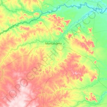
Montalvânia topographic map
Interactive map
Click on the map to display elevation.
About this map
Name: Montalvânia topographic map, elevation, terrain.
Average elevation: 585 m
Minimum elevation: 444 m
Maximum elevation: 808 m
Montalvânia is a municipality in the northernmost point of the state of Minas Gerais in Brazil. As of 2008 the population was 16,265 in an area of 1,484.388 km². The elevation of the municipal seat is 510 meters, the postal code (CEP) is 39495-000 and it is located in the microregion of Januária