
De Grey topographic map
Interactive map
Click on the map to display elevation.
About this map
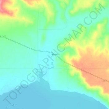
Name: De Grey topographic map, elevation, terrain.
Location: De Grey, Hughes County, South Dakota, United States (44.26582 -99.93790 44.30582 -99.89790)
Average elevation: 460 m
Minimum elevation: 429 m
Maximum elevation: 533 m
Other topographic maps
Click on a map to view its topography, its elevation and its terrain.
Hughes County
United States > South Dakota > Hughes County
Hughes County, South Dakota, United States
Average elevation: 537 m