
San Roque topographic map
Interactive map
Click on the map to display elevation.
About this map
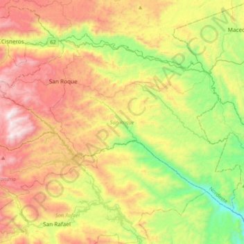
Name: San Roque topographic map, elevation, terrain.
Location: San Roque, Nordeste, Antioquia, Colombia (6.31358 -75.10712 6.54819 -74.78156)
Average elevation: 1,130 m
Minimum elevation: 438 m
Maximum elevation: 2,023 m
Other topographic maps
Click on a map to view its topography, its elevation and its terrain.
Nendo
Colombia > Antioquia > La Condota
Nendo, La Condota, Urrao, Suroeste, Antioquia, Colombia
Average elevation: 1,032 m