
Warren County topographic map
Interactive map
Click on the map to display elevation.
About this map
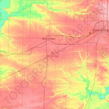
Name: Warren County topographic map, elevation, terrain.
Location: Warren County, Illinois, USA (40.62765 -90.78902 41.06970 -90.43973)
Average elevation: 218 m
Minimum elevation: 165 m
Maximum elevation: 254 m
Other topographic maps
Click on a map to view its topography, its elevation and its terrain.
Northbrook
USA > Illinois > Northbrook
Northbrook, Cook County, Illinois, 60062, USA
Average elevation: 201 m
Douglas Park
USA > Illinois > Douglas Park
Douglas Park, Whiteside County, Illinois, 61037, USA
Average elevation: 197 m
Garfield Ridge
Garfield Ridge, Chicago, Cook County, Illinois, USA
Average elevation: 184 m
Montague Island
Montague Island, Rockford, Winnebago County, Illinois, 61104, USA
Average elevation: 254 m