
Malayattoor topographic map
Interactive map
Click on the map to display elevation.
About this map
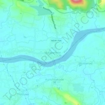
Name: Malayattoor topographic map, elevation, terrain.
Location: Malayattoor, Ernakulam, Kerala, KERALA 683544, India (10.17995 76.51334 10.21995 76.55334)
Average elevation: 51 m
Minimum elevation: 1 m
Maximum elevation: 309 m