
Windy Harbour topographic map
Interactive map
Click on the map to display elevation.
About this map
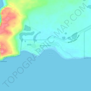
Name: Windy Harbour topographic map, elevation, terrain.
Location: Windy Harbour, Western Australia, Australia (-34.85566 116.00713 -34.81566 116.04713)
Average elevation: 17 m
Minimum elevation: -1 m
Maximum elevation: 104 m
Other topographic maps
Click on a map to view its topography, its elevation and its terrain.
Windy Harbour
Australia > Western Australia > Windy Harbour
Windy Harbour, Shire Of Manjimup, Western Australia, Australia
Average elevation: 42 m