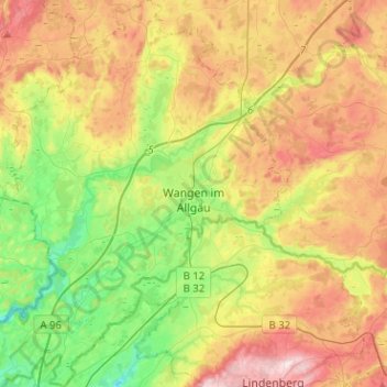
Wangen im Allgäu topographic map
Interactive map
Click on the map to display elevation.
About this map
Name: Wangen im Allgäu topographic map, elevation, terrain.
Average elevation: 620 m
Minimum elevation: 464 m
Maximum elevation: 821 m

Click on the map to display elevation.
Name: Wangen im Allgäu topographic map, elevation, terrain.
Average elevation: 620 m
Minimum elevation: 464 m
Maximum elevation: 821 m