
Mangrove Creek topographic map
Interactive map
Click on the map to display elevation.
About this map
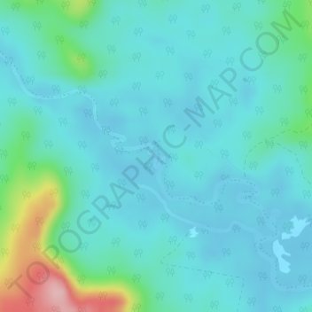
Name: Mangrove Creek topographic map, elevation, terrain.
Average elevation: 33 m
Minimum elevation: 3 m
Maximum elevation: 176 m
Other topographic maps
Click on a map to view its topography, its elevation and its terrain.
Lawrence Road
Australia > Grafton > Lawrence Road
Lawrence Road, Grafton, Clarence Valley Council, Australia
Average elevation: 72 m
Alumy Creek
Alumy Creek, Grafton, Clarence Valley Council, Australia
Average elevation: 5 m