
Fargo topographic map
Interactive map
Click on the map to display elevation.
About this map
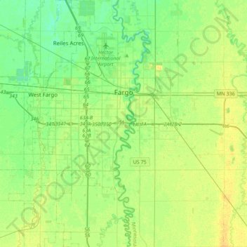
Name: Fargo topographic map, elevation, terrain.
Location: Fargo, Cass County, North Dakota, United States (46.73143 -96.90377 46.96295 -96.75284)
Average elevation: 277 m
Minimum elevation: 268 m
Maximum elevation: 287 m
Other topographic maps
Click on a map to view its topography, its elevation and its terrain.
Horace
United States > North Dakota > Cass County
Horace, Cass County, North Dakota, United States
Average elevation: 278 m
Kindred
United States > North Dakota > Cass County
Kindred, Cass County, North Dakota, United States
Average elevation: 288 m
Fargo
United States > North Dakota > Cass County > Fargo
Fargo, Cass County, North Dakota, 58102-4608, United States
Average elevation: 277 m
Harwood
United States > North Dakota > Cass County > Harwood
Harwood, Cass County, North Dakota, 58042, United States
Average elevation: 272 m