
Baucau topographic map
Interactive map
Click on the map to display elevation.
About this map
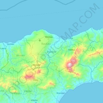
Name: Baucau topographic map, elevation, terrain.
Location: Baucau, East Timor (-8.70311 126.15018 -8.41480 126.81182)
Average elevation: 222 m
Minimum elevation: 0 m
Maximum elevation: 2,262 m
Other topographic maps
Click on a map to view its topography, its elevation and its terrain.
trail route
East Timor > Dili > Dili > Akrema
trail route, Akrema, Dili, East Timor
Average elevation: 42 m