
Pincushion Island topographic map
Interactive map
Click on the map to display elevation.
About this map
Name: Pincushion Island topographic map, elevation, terrain.
Average elevation: 6 m
Minimum elevation: -3 m
Maximum elevation: 24 m
Other topographic maps
Click on a map to view its topography, its elevation and its terrain.
Harwich
United Kingdom > England > Tendring
Harwich, Tendring, Essex, England, United Kingdom
Average elevation: 1 m
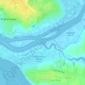
Brightlingsea
United Kingdom > England > Tendring
Brightlingsea, Tendring, Essex, England, United Kingdom
Average elevation: 8 m
Frinton and Walton
United Kingdom > England > Tendring
Frinton and Walton, Tendring, Essex, East of England, England, United Kingdom
Average elevation: 5 m