
Sonipat topographic map
Interactive map
Click on the map to display elevation.
About this map
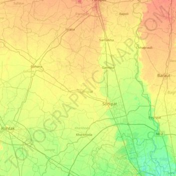
Name: Sonipat topographic map, elevation, terrain.
Location: Sonipat, Haryana, India (28.81490 76.46690 29.29471 77.23184)
Average elevation: 225 m
Minimum elevation: 204 m
Maximum elevation: 250 m
Other topographic maps
Click on a map to view its topography, its elevation and its terrain.
Para River
India > Haryana > Siwan > KACHI PISOL
Para River, KACHI PISOL, Siwan, Kaithal District, Haryana, 136033, India
Average elevation: 235 m