
Benarkin topographic map
Interactive map
Click on the map to display elevation.
About this map
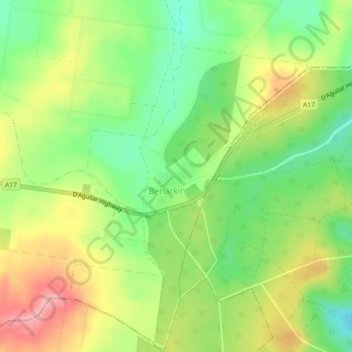
Name: Benarkin topographic map, elevation, terrain.
Location: Benarkin, Queensland, Australia (-26.90617 152.11753 -26.86617 152.15753)
Average elevation: 447 m
Minimum elevation: 389 m
Maximum elevation: 517 m
Other topographic maps
Click on a map to view its topography, its elevation and its terrain.
Benarkin North
Australia > Queensland > Benarkin
Benarkin North, Benarkin, Queensland, Australia
Average elevation: 417 m