
Thaur topographic map
Interactive map
Click on the map to display elevation.
About this map
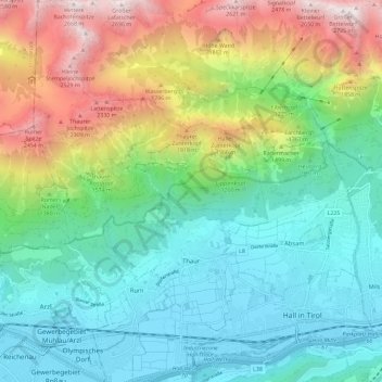
Name: Thaur topographic map, elevation, terrain.
Location: Thaur, Innsbruck-Land, Tyrol, 6065, Austria (47.26798 11.42606 47.34637 11.49719)
Average elevation: 1,209 m
Minimum elevation: 554 m
Maximum elevation: 2,701 m