
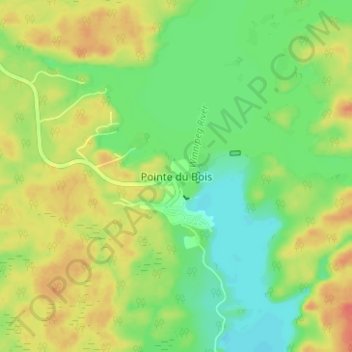
Pointe du Bois topographic map
Interactive map
Click on the map to display elevation.
About this map
Name: Pointe du Bois topographic map, elevation, terrain.
Location: Pointe du Bois, Manitoba, Canada (50.28074 -95.57084 50.32074 -95.53084)
Average elevation: 306 m
Minimum elevation: 283 m
Maximum elevation: 333 m