
Marondera topographic map
Interactive map
Click on the map to display elevation.
About this map
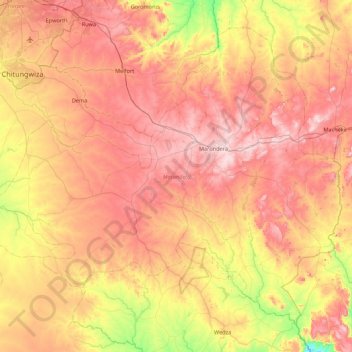
Name: Marondera topographic map, elevation, terrain.
Location: Marondera, Mashonaland East, Zimbabwe (-18.60565 30.99127 -17.90543 31.86314)
Average elevation: 1,458 m
Minimum elevation: 1,178 m
Maximum elevation: 1,716 m
Other topographic maps
Click on a map to view its topography, its elevation and its terrain.