
Bournda National Park topographic map
Interactive map
Click on the map to display elevation.
About this map
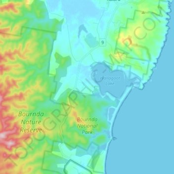
Name: Bournda National Park topographic map, elevation, terrain.
Average elevation: 59 m
Minimum elevation: -3 m
Maximum elevation: 311 m
Other topographic maps
Click on a map to view its topography, its elevation and its terrain.
Wallagoot Lake
Australia > New South Wales > Bournda
Wallagoot Lake, Bournda, Bega Valley Shire Council, New South Wales, 2548, Australia
Average elevation: 15 m