
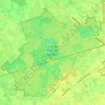
Nationaal Park De Groote Peel topographic map
Interactive map
Click on the map to display elevation.
About this map
Name: Nationaal Park De Groote Peel topographic map, elevation, terrain.
Average elevation: 29 m
Minimum elevation: 18 m
Maximum elevation: 33 m
Other topographic maps
Click on a map to view its topography, its elevation and its terrain.
Schoor
Nederland > Limburg > Nederweert > Schoor
Schoor, Nederweert, Limburg, Nederland, 6031, Nederland
Average elevation: 33 m