
Fly Island topographic map
Interactive map
Click on the map to display elevation.
About this map
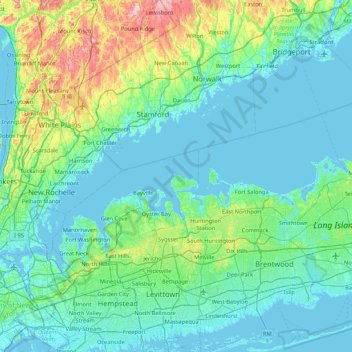
Name: Fly Island topographic map, elevation, terrain.
Location: Fly Island, Lloyd Harbor, Suffolk County, New York, USA (40.61954 -73.80179 41.25954 -73.16179)
Average elevation: 38 m
Minimum elevation: -6 m
Maximum elevation: 258 m