
Cleves topographic map
Interactive map
Click on the map to display elevation.
About this map
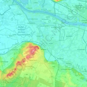
Name: Cleves topographic map, elevation, terrain.
Average elevation: 24 m
Minimum elevation: 7 m
Maximum elevation: 101 m
Other topographic maps
Click on a map to view its topography, its elevation and its terrain.
Rees
Germany > North Rhine-Westphalia > Kreis Kleve > Rees
Rees, Kreis Kleve, North Rhine-Westphalia, 46459, Germany
Average elevation: 18 m