
Ferntree Creek National Park topographic map
Interactive map
Click on the map to display elevation.
About this map
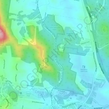
Name: Ferntree Creek National Park topographic map, elevation, terrain.
Average elevation: 49 m
Minimum elevation: 5 m
Maximum elevation: 209 m
Other topographic maps
Click on a map to view its topography, its elevation and its terrain.
Yandina
Australia > Queensland > Yandina
Yandina, Sunshine Coast Regional, Queensland, 4561, Australia
Average elevation: 52 m
Cooloolabin Dam
Australia > Queensland > Yandina
Cooloolabin Dam, Cooloolabin Road, Ninderry, Yandina, Queensland, 4561, Australia
Average elevation: 294 m